San Pablo Avenue is ever-changing

By Steve Price
San Pablo Avenue is presently designated as California State Route 123. It originated during the Spanish colonial era and was then called Camino de la Contra Costa. In the American era it became Contra Costa Road and then San Pablo Avenue. In 1927 it became part of the Lincoln Highway, America's first transcontinental highway. A streetcar line ran on it between Oakland and Richmond. El Cerrito was largely rural at the time, but eventually the Eastshore Freeway (I-80) assumed the role of major north/south travel and San Pablo Avenue became increasingly urbanized — less an interurban highway and more an urban avenue.
The designation of State Route 123 for San Pablo Avenue does not go the full length of the Avenue, only a little over 7 miles out of a total of over 22 miles. State Route 123 goes from I-580 in Oakland to Cutting Boulevard at Del Norte, where it makes a dogleg over to the I-80 northbound on-ramp. Why so short? That’s because this stretch is close to and parallels I-80, thus serving as congestion relief if I-80 jams up.
Can San Pablo Avenue be both an urban avenue enriched by housing with access to local serving retail, and a way for fast-moving motorists going long distances to bypass freeway slowdowns? Distant sprawl development fueled the desire of motorists to travel fast. But in an era of frightening climate change, deferring to long-distance, high-speed travel at the expense of safe access to what's local makes less and less sense. We must start prioritizing local travel to support local businesses and reduce greenhouse-gas emissions.
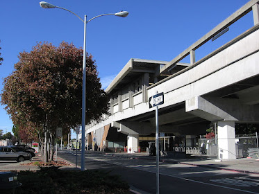
The evolution of San Pablo Avenue
From this (a highway):

To this (an urban avenue):


Comments
Post a Comment